


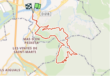

8.4 km | 10.5 km-effort

User GUIDE


FREE GPS app for hiking
 SityTrail
IGN / Geographical institutes
SityTrail World
The world is yours!
Trail Walking of 10.9 km to be discovered at Occitania, Pyrénées-Orientales, Le Boulou. This trail is proposed by toutankhcarton.
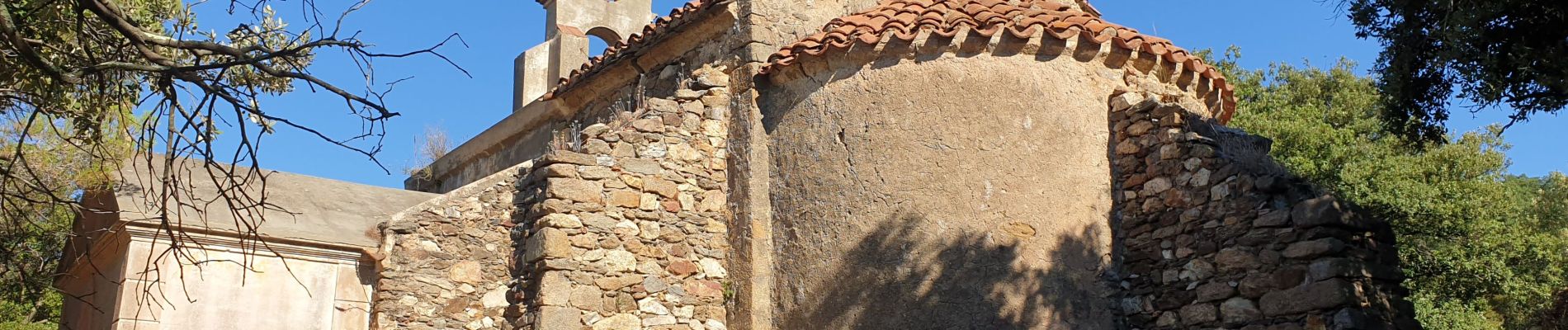
Montée au Pic Estelle depuis le casino Joa. Petit raidillon au départ puis passage par la chapelle romane St Pierre de Laner (XIIe).
Regagner la piste en contre bas de la chapelle pour revenir au Boulou.
 - Le Boulou - Pyrénées orientales (66) - Photo 1")
 - Le Boulou - Pyrénées orientales (66) - Photo 2")
 - Le Boulou - Pyrénées orientales (66) - Photo 3")
 - Le Boulou - Pyrénées orientales (66) - Photo 4")
 - Le Boulou - Pyrénées orientales (66) - Photo 5")
 - Le Boulou - Pyrénées orientales (66) - Photo 6")
 - Le Boulou - Pyrénées orientales (66) - Photo 7")

Walking

Walking

Walking

Walking

Walking

Walking

Hybrid bike

Walking
Walking